How much does a land survey cost and how do I get one?
Contributed by Karen Idelson
Updated Mar 14, 2026
•6-minute read

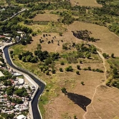
A land survey can be a critical step when you’re buying a property. It maps out exactly what you're purchasing. Whether you're buying a single-family home or a larger parcel, understanding your property's boundaries, features, and potential issues can save you time and money and help avoid issues down the road.
While the average land survey costs around $2,300, the final price depends on several factors, including the size and complexity of your property, its location, and the type of survey you need. To help you navigate this process, we'll break down the different types of surveys available, explain how to obtain one, outline what you can expect to pay, and show you how a survey protects your interests as a property owner.
What is a land survey?
A land survey is used to map out the shape and boundaries of a piece of land. It’s an exact drawing of the dimensions of the parcel, as well as any physical features, both natural and manufactured.
Essentially, a land survey provides you with a documented understanding of the boundaries of a property. What’s included in a land survey will depend on the depth of the type of survey you plan to have conducted. At a minimum, a land survey includes measuring land and recording the boundaries, elevation levels, and angles of a parcel of land.
See what you qualify for
Why you might need a land survey
To survey your land, you'll need to hire a professional who is qualified to perform legal land surveys. Land surveyors use different methods depending on the size and shape of the property.
Here are some of the reasons you may need to hire a land surveyor:
- Fulfills mortgage requirements: When applying for a mortgage, you may be required to hire a land surveyor to conduct a land survey on the property. This will depend on the type of mortgage you’re applying for and whether your mortgage lender legally requires it.
- Resolves disputes with neighbors: Land surveys can help resolve boundary issues with neighbors. This is a great way to practice good neighbor etiquette.
- To buy or sell real estate: You’ll want to know exactly what’s included if you plan to sell or buy a piece of land.
- To install utilities: You’ll need to know boundary lines to put utilities on your property. You’ll also need a land survey if you’re putting in a new septic system.
- To divvy up the land: A land survey is necessary if you plan to create smaller lots of land out of the larger parcel.
- To update a survey: You have an outdated land survey and need a refreshed one.
Take the first step toward the right mortgage
Apply online for expert recommendations with real interest rates and payments
How much does a land survey cost?
So how much is a land survey? The cost to survey land typically ranges from $475 to $25,000, with an average price hovering at $2,300. This price, and all others mentioned in the article, come from Angi, which has an in-depth methodology to determine average costs.
This price can vary significantly, depending on the location, type of survey, dimensions of the property, terrain, and level of accessibility to the property.
Location
Location affects cost in two ways: regional pricing and accessibility. Prices for a land survey can vary significantly across the country. In turn, a land survey near Boston, Massachusetts, may cost quite a bit more than a land survey near Tulsa, Oklahoma, for the same size plot.
But location is not limited simply to state or region. If a piece of land is difficult to get to, perhaps without an access road, the price can increase.
According to Angi, a land survey can cost between $800 and $5,500. In New York, the range is from $1,400 to $6,000. In Ohio, it can cost between $900 and $3,800.
Terrain
If the land needing a survey is undeveloped or uncleared, the cost of the land survey can go up. Brush, woodlands, rocky outcrops, and dense vegetation can make for a more complex survey, resulting in an increased price.
This is particularly true if the land is potentially treacherous, such as a large plot of land with possibly abandoned mine shafts. However, if you’re looking to survey a small plot in a neighborhood, the terrain is unlikely to be a significant factor.
Dimensions
Understandably, the size of a property is going to have a significant impact on the cost. A plot smaller than an acre will likely fetch you a price below $1,000, but a plot of 40 acres will likely send you into the five-digit zone.
Survey type
There are seven main types of land surveys, all with different purposes and varying levels of depth and cost.
Further, some surveys require more time and expertise. For example, an American Land Title Association (ALTA) survey can involve more time and expertise. They're most commonly required when purchasing commercial property and tend to be more expensive than a standard boundary survey.
Need extra cash for home improvement?
Use your home equity for a cash-out refinance
7 types of land surveys
Different types of land surveys are used for varying purposes. Here are the most common types of land surveys and the average cost of each.
Keep in mind that the average costs vary widely, and you may find surveys outside this range on either side, depending on location and other factors.
1. Boundary survey
This type of land survey is used to locate the corners and property boundary lines of a parcel of land. A boundary survey will use both recorded deeds and physical markers to define the boundary lines on a piece of land.
A boundary survey does require both record and field research. It’s typically used for personal records and locating easements.
Average cost: $1,200 – $5,500
2. ALTA survey
An American Land Title Association (ALTA) survey provides a lender and/or title company with the required survey data to deliver an ALTA insurance policy.
As mentioned, ALTA surveys tend to be more comprehensive than a standard boundary survey. They're also more commonly done before purchasing a piece of property or investing in a new home.
Average cost: $2,500 – $10,000
3. Topographic survey
Also known as contour surveys, topographic surveys are used to understand the locations of both human-made and natural features on a parcel of land. These features may include roads, buildings, ditches, trees, streams, and utilities.
This type of survey is most commonly used by architects and engineers working on property improvement plans.
Average cost: $2,000 – $6,500
4. As-built survey
As the name implies, an as-built survey shows what was actually built versus what was originally planned. An as-built survey is best for those who are planning to build a large home or work on a landscape construction project.
A professional surveyor provides a three-dimensional rendering of your home using lasers. An as-built survey can provide you with interior and exterior blueprints, which are highly accurate.
Average cost: $1,600 – $3,800
5. Mortgage survey
Similar to an ALTA survey, a mortgage survey is used when purchasing a home or piece of property. It verifies structures on the property, land and property title owners, and that the property meets all building and zoning codes before the purchase is made.
Average cost: $1,500 – $4,500
6. Subdivision survey
This survey is used to divide a piece of land into smaller pieces, also called lots. A subdivision survey must be filed with government agencies, typically at both the local and state levels.
Average cost: $300 - $1,000 per lot
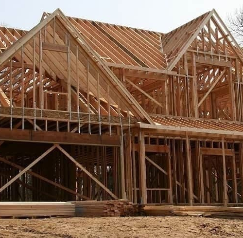
7. New construction survey
A new construction survey, or pre-construction survey, is necessary before establishing structures on a parcel of land, including roads, utilities, and buildings. This type of survey utilizes both vertical and horizontal grading. As it's more involved, new construction surveys tend to be pricier.
Vertical positions are verified by differences in elevations in comparison to a specific location on the property, which is known as the benchmark. Horizontal positions are determined by distances between structures.
Average cost: $1,800 – $6,500
How to get a land survey
In some cases, you may be able to use an existing survey. For example, if you and a neighbor have a property line dispute.
But should you need a new survey, you can turn to the National Society of Professional Surveyors (NSPS) to find a surveyor in your state. This organization has affiliates in all 50 states. You can use the NSPS map to check your state's surveying society page.
Once you find a surveyor you may want to work with, you can narrow down your options by comparing price estimates and customer reviews.
The three stages of a land survey are:
- Research on property boundaries. The land surveyor may need to go to different government agencies to get the needed information. This can take as long as a few days and depends on the size and boundaries of the land.
- Fieldwork. The land surveyor may need to look at the nearby area to assess. They might also need to look for boundary markers such as pins and pipes.
- Computation. The analysis and computation stage involves looking at the data, analyzing results, and putting together all the information and putting together the final report.
The entire process can take anywhere from a few days to several weeks. The length of time depends on the complexity, size, and boundaries of the land.
The bottom line: Land surveys can clarify your property lines
A land survey is a valuable tool that can help you determine property lines and characteristics. In turn, it can help you avoid costly disputes, foresee potential zoning issues, and help you understand exactly what you’re buying. Whether you’re a first-time home buyer or experienced property owner, land surveys can offer important insights into your potential purchase.
If you're in the market for a house, you can apply for a loan with Rocket Mortgage today.

Jackie Lam
Jackie Lam is a seasoned freelance writer who writes about personal finance, money and relationships, renewable energy and small business. She is also an AFC® financial coach and educator who helps creative freelancers and artists overcome mental blocks and develop a healthy relationship with their finances. You can find Jackie in water aerobics class, biking, drumming and organizing her massive sticker collection.
Related resources
9-minute read
Buying undeveloped land: Pros, cons, and financing tips
Scouting the perfect spot for your dream home? Learn about purchasing undeveloped land, including financing, development costs, and key considerations.
Read more
11-minute read
Building vs. buying a home: Which is cheaper?
In the market for a new home? The costs of building vs. buying depend on your market, building supplies, and more. Learn how to compare new vs. existing homes.
Read more
7-minute read
Cheapest ways to build a house: 12 tips for affordable home building
Building a home doesn’t have to break the bank. Explore these 12 ways to build a budget-friendly house, from a simpler layout to opting for cheaper materi...
Read more